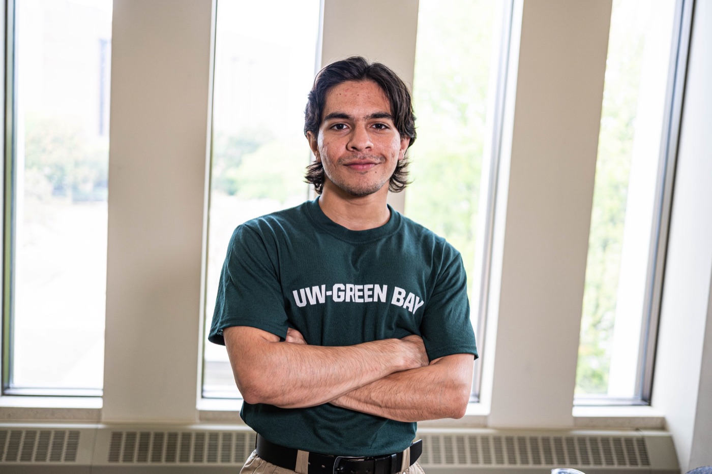
Portrait of Muhammad Raffay Chaudhry
Applying to PhD programs · Fall 2027

Muhammad Raffay Chaudhry
listening to the solid Earth.

Geoscience senior at the University of Wisconsin–Green Bay. I study how fluids and stress move through rock and ice, using seismic signals and geophysical surveys to see what happens underground.

01 — About

Fluids, rock, and ice under stress.

I'm from Pakistan and came to Wisconsin to study geoscience, first at St. Norbert College and then at UW–Green Bay. I've been drawn to the questions you can't see directly: what water is doing inside rock, how a slope weakens before it fails, how a reservoir responds when CO₂ is pushed into it.

I taught myself Python and began building my own tools for seismic data, from waveform processing in ObsPy and SAC to a pipeline that detects P-wave arrivals automatically. This summer I completed the 12-week NSF–EarthScope Seismology Skill Building Workshop. As a research assistant on four projects, I've run electromagnetic surveys, measured fluid inclusions from an ore deposit, and sampled soils and water across Wisconsin.

For my PhD I want to work where fluid flow meets rock and ice mechanics, whether that means monitoring induced seismicity at a carbon storage site, detecting landslides from seismic signals, or understanding how meltwater changes the way an ice sheet moves.

Subsurface

Carbon storage

Geomechanics and monitoring of CO₂ injection: pressure, fluid migration, and induced seismicity.

Hazards

Seismic monitoring

Detecting earthquakes, landslides, and other mass movements in continuous seismic records.

Cryosphere

Ice sheet dynamics

Basal hydrology, glacial seismicity, and models of how ice flows and fractures.
3.96
GPA · Dean's List every term
4
Research assistantships
3
Conference posters
Dec 2026
B.S. Geoscience
02 — Research

Projects

2026Independent project

Seismic signal processing & P-wave detection

A Python and ObsPy pipeline that pulls waveform data from FDSN web services and applies STA/LTA triggers to detect P-wave arrivals automatically.

  • Python
  • ObsPy
  • STA/LTA
  • FDSN
Methods & validation
Data
Waveforms retrieved programmatically through FDSN web services.
Method
Bandpass filtering followed by a short-term / long-term average (STA/LTA) trigger to flag the onset of the P-wave.
Validation
Tested on a real earthquake recorded at station COP (Copenhagen, Denmark) on 19 February 2009, bandpass filtered 0.5–8 Hz to isolate the arrival from background noise.
Code
github.com/Raffaycodes/Seismic-P-wave-Detection
Oct 2025 – Sep 2026Geophysics RA · Dr. John Luczaj

EM-31 survey for municipal water-main leak detection

Electromagnetic surveys mapping subsurface conductivity around a suspected municipal water-main leak, turned into GIS conductivity maps and anomaly models.

  • EM-31
  • ArcGIS Pro
  • Gridding
  • Anomaly mapping
Methods & results
Problem
A suspected leak near a municipal water main, with utility records that disagreed on where the main actually ran.
Method
EM-31 terrain conductivity surveys over the site, gridded into high-resolution GIS conductivity maps and spatial anomaly models.
Result
The conductivity anomalies resolved the conflicting utility records of the main's location.
Output
Presented at the AIPG National Conference, Duluth, MN (2026). Awarded Best Poster Presentation.
Dec 2025 – Jul 2026Fluid inclusion RA · Dr. John Luczaj

Ore-forming fluids at Eagle Mine, Michigan

Fluid inclusion microthermometry to characterize the fluids that formed the ore at Eagle Mine and how their temperature changed through time.

  • Microthermometry
  • Thin sections
  • Petrography
  • Fluid–rock interaction
Methods
Samples
Thin sections prepared from Eagle Mine material.
Method
Petrographic observation of inclusion assemblages combined with heating and freezing measurements.
Goal
Constrain the temperature evolution of the mineralizing fluids.
Nov 2025 – Aug 2026Soils RA · Dr. Kevin Fermanich, CSET

Baseline soils for an agrivoltaic conversion

Soil characterization of farmland being converted to solar, establishing a baseline before the panels go in.

  • Soil coring
  • Flash 2000 CHNS
  • GIS
  • Power analysis
Methods
Field & lab
Soil sampling, bulk density, and C/N concentration analysis on a Flash 2000 elemental analyzer.
Analysis
GIS spatial analysis across the study plots to evaluate site suitability and map nutrient distribution. Independently ran a power analysis to test whether the sampling design had an adequate sample size.
Water
Worked with a graduate researcher on water sampling to quantify metal concentrations.
Output
Poster at the UWGB Academic Excellence Symposium (2026).
Nov 2025 – Mar 2026Hydrology RA · Dr. Matthew Dougherty

Phosphate transport in creeks, rivers, and lakes

Collected and analyzed water samples across connected creek, river, and lake systems to assess total phosphate distribution and nutrient transport.

  • Water sampling
  • Nutrient analysis
  • Hydrology

Presentations

  • Chaudhry, M.R., Luczaj, J., & Warr, L. (2026). EM-31 Geophysical Survey for Municipal Water-Main Leak Detection. AIPG National Conference, Duluth, MN. Best Poster
  • Chaudhry, M.R. & Warr, L. (2026). Storm Drains as a Source of Phosphate in a Small Southeast Wisconsin Lake. St. Norbert College Symposium.
  • Chaudhry, M.R. & Fermanich, K. (2026). Baseline Soil Characterization of a Site Undergoing Agrivoltaic Conversion. UWGB Academic Excellence Symposium.
03 — Education & training

Education, field & lab

  • 2024 – 2026
    B.S. Geoscience
    University of Wisconsin–Green Bay · expected Dec 2026
    GPA 3.96 / 4.00 · Dean's List every semester
  • 2023 – 2024
    St. Norbert College
    De Pere, Wisconsin · GPA 4.00 / 4.00
  • Jun – Aug 2026
    Seismology Skill Building Workshop
    NSF & EarthScope
    12-week program in scientific computing, observational seismology, seismic data analysis, and applied Python (ObsPy).

Field & lab

  • Jan 2027
    Volcanology Field Camp, Big Island of Hawaiʻi
    South Dakota School of Mines & Technology · AAPG-funded
    Mapping lava flow stratigraphy and pāhoehoe and ʻaʻā structures in an active rift zone with GPS traverses, compass-and-clinometer mapping, and sampling for petrography.
  • 2026
    Precambrian terranes of Lake Superior
    UW–Green Bay geoscience field trip
    Outcrop mapping and stratigraphic correlation across the Penokean, Yavapai, and Baraboo orogenic belts.
  • 2024
    Northwoods of Wisconsin & Upper Peninsula, Michigan
    Mineralogy field trip
    Glacial stratigraphy, Penokean structures, and igneous assemblages including the Wolf River Batholith.
  • 2024
    Core & geochemistry lab
    UW–Green Bay
    Logged over 1,000 feet of drill core for the composite stratigraphic column of northeastern Wisconsin. Measured chloride, phosphorus, nitrate, carbon, and nitrogen by flame photometry and colorimetry, plus TSS/VSS.

Certifications

  • 2025 – 2026
    MIT OpenCourseWare
    Intro to CS & Python · Computational Thinking & Data Science
  • 2025
    Seismic Data Processing Certification
    Universiti Sains Malaysia
  • 2024
    ArcGIS Certification
    Esri
04 — Recognition

Honors & awards

  • 2026
    SEG / P.C. Havens / Seismic Exchange Scholarship
    Society of Exploration Geophysicists · one student per academic year
  • 2026
    Best Poster Presentation
    AIPG National Conference
  • 2026
    AAPG Field Camp Scholarship
    American Association of Petroleum Geologists · funds Hawaiʻi volcanology field camp
  • 2025 & 2026
    AIPG National Award
    American Institute of Professional Geologists · consecutive years
  • 2026
    Morgan-Macaluso Scholarship
    College of Science, Engineering & Technology, UW–Green Bay · one to three students a year
  • 2024
    Exemplary Leadership Award
    St. Norbert College · five first-year students
    For organizing a town hall during campus budget cuts, attended by a third of the student body.
05 — Toolkit

Skills

Computational

Python (NumPy, ObsPy, Pandas, Matplotlib), Jupyter, SAC, GMT, Unix/Linux shell, ArcGIS Pro, QGIS

Seismology

STA/LTA event detection, filtering, component rotation, spectrograms, instrument response removal, FDSN/SAGE data retrieval

Geophysics & geodesy

EM-31 conductivity surveying, data gridding and anomaly mapping, geodetic time-series analysis

Field & lab

Geologic and volcanic mapping, drill-core logging, soil coring, water sampling, petrographic microscopy, fluid inclusion microthermometry, CHNS elemental analysis

06 — Outside the lab

Leadership & life

  • 2025 – now
    Student Body President & Shared Governance Chair
    UW–Green Bay Student Government Association
    Co-authored the first AI policy framework in UW System history with the Board of Regents. Represented 13,000 students, expanded the Senate from 4 to 30 members, and led a team of 40+ student leaders. Served as student representative on the search committee for the 10th President of the UW System, representing 165,000+ students, and coordinated student governance across 12 UW campuses.
  • 2025
    President, Muslim Students Association & Geology Club
    UW–Green Bay
    Organized a campus-wide Ramadan iftar for 150+ attendees that raised $1,500, ran bi-weekly programming drawing 100+ participants, and rebuilt the Geology Club's visual identity with the Graphic Design department.
  • 2023 – 2025
    Competitive powerlifter
    USA Powerlifting & Pakistan Powerlifting Federation
    Ranked 2nd in Pakistan (Junior, 59 kg). USAPL nationals qualifier representing St. Norbert College.
07 — Contact

Looking for a PhD lab for Fall 2027.

If your group works on carbon storage, seismic monitoring, or ice dynamics, I'd be glad to hear from you.